

Today, UAVs have become an accessible and reliable tool for a great variety of clients from all kinds of industries: transportation; construction; agriculture; forestry; environment; and many more. FALCON has a fleet of drones at its disposal that can cater to your requirements, from UAVs to drone manoeuvring, on grounds or water.
FALCON has a team of certified pilots and qualified personnel with a variety of skills to provide to your needs. See a sample of our services offered below.
Please contact drones@falconenvironemental.com for more details on these products and services, or for any price request.
UAV SURVEY

FALCON can virtually survey any piece of land, from construction sites to a more sensitive area such as airfields and airports. Our qualified personnel are waiting to hear from you. You are unsure if it can be done? Don’t hesitate to call us, we can help you decipher if an UAV survey is the right solution for you. Our service is always performed with the highest safety standard in the industry.
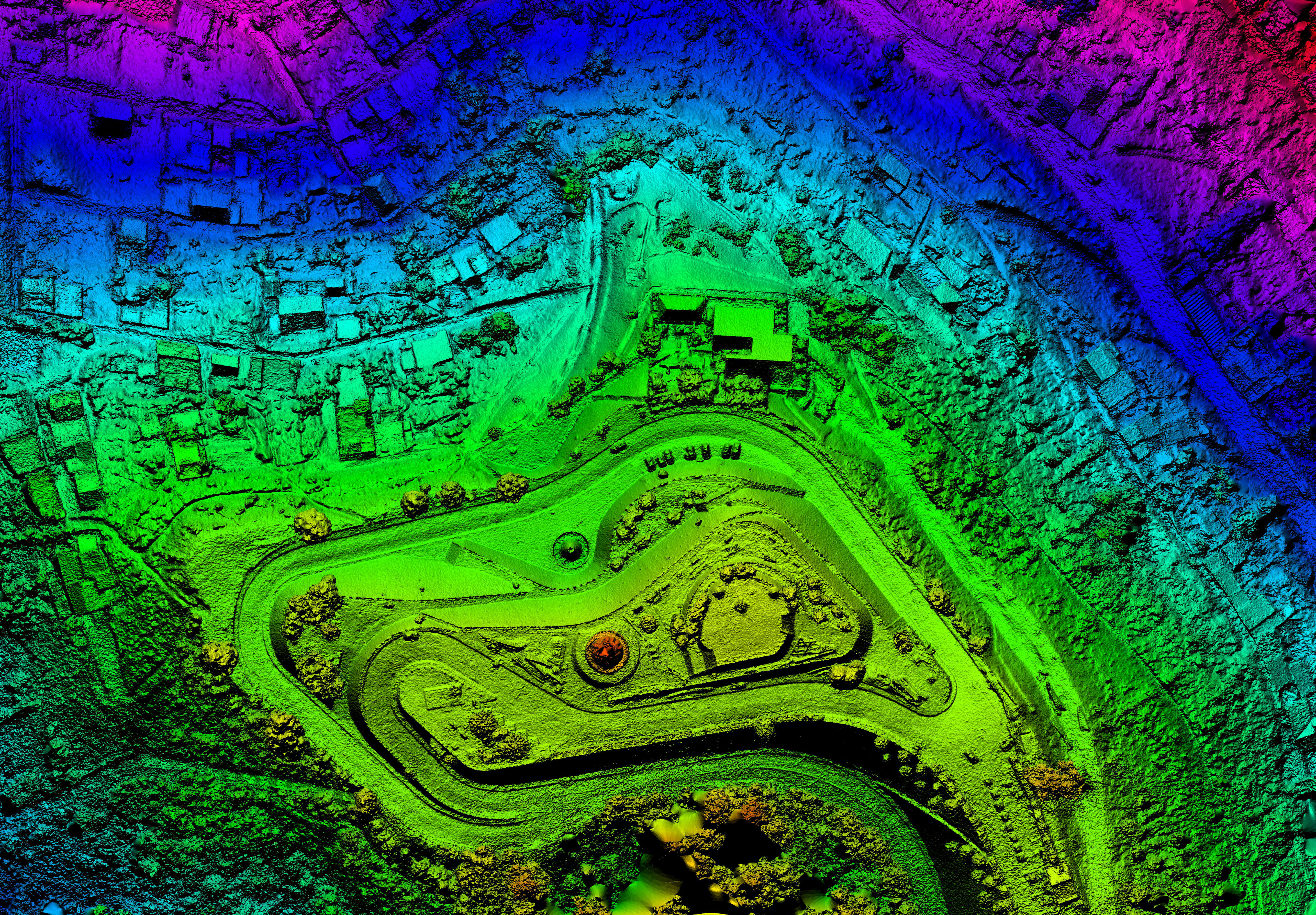
Land Characterization
Land feature characterization is the main interest of UAV surveying. FALCON’s UAVs can identify very small features within large areas. Our basic land characterization service include:
- Topography Mapping
- Stock Pile & Volumes Calculations
- Land Feature and Structural Identification
Wildlife Detection & Control

FALCON started using UAVs in 2010 to detect protected and endangered species. Since then, our environment and wildlife services based on UAVs diversified according to the technology breakthrough. FALCON’s UAVs can quickly detect wildlife in sensitive areas, such as airports. Our UAV solution can also overcome the challenges of having to cover a large and/or non-accessible and/or hostile area.
FALCON also offers UAV services to control undesirable wildlife at airports, landfills and other areas. All wildlife controls done with the use of an UAV are performed ethically and legally. No wildlife is injured through our UAV services. FALCON’s qualified personnel apply the predator-prey relationship to scare the undesirable or hazardous wildlife away. This is a simple extension of the wildlife management performed at airports since 1992 with trained birds of prey to scare away wild birds that are a hazard to aircrafts.

![]()
FALCON is the official North American distributor of WINGBEAT products.
Do not hesitate to contact us for more information or a quote.
Remote Sensing

FALCON provides a great variety of land detection and characterization technics. Using a mix of land data sources, such as Landsat Imagery, Orthophotos, and UAV survey data, we can provide our clients with unparallel land feature characterization.

Spatial Analysis


Having a lot of land data is only helpful if it can be processed, analyzed and structured in such a way it meets the client’s needs. FALCON has many years of land feature analysis and data representation. Your data set can only get bonified with the services of our team of highly qualified personnel.


