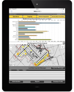
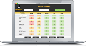
The Wildlife Management System (WMS©) is a software that allows for one-touch data input, data analysis and geolocation of wildlife management activities on airport grounds in addition to providing a framework for designing reports of these activities (including KPIs, heat maps, critical zones and alerts).
Features
- Portable, based on iPad and computer
- User-friendly and intuitive interface
- Real-time data validation
- Remote data storage and access
- Integrated geolocalization (GPS)
- Automatic reporting
- Automatic alerts
- Allows communication between users
- Collect and export all strike information required by TC
- Visual reports using graphs, pictures, maps and heat maps
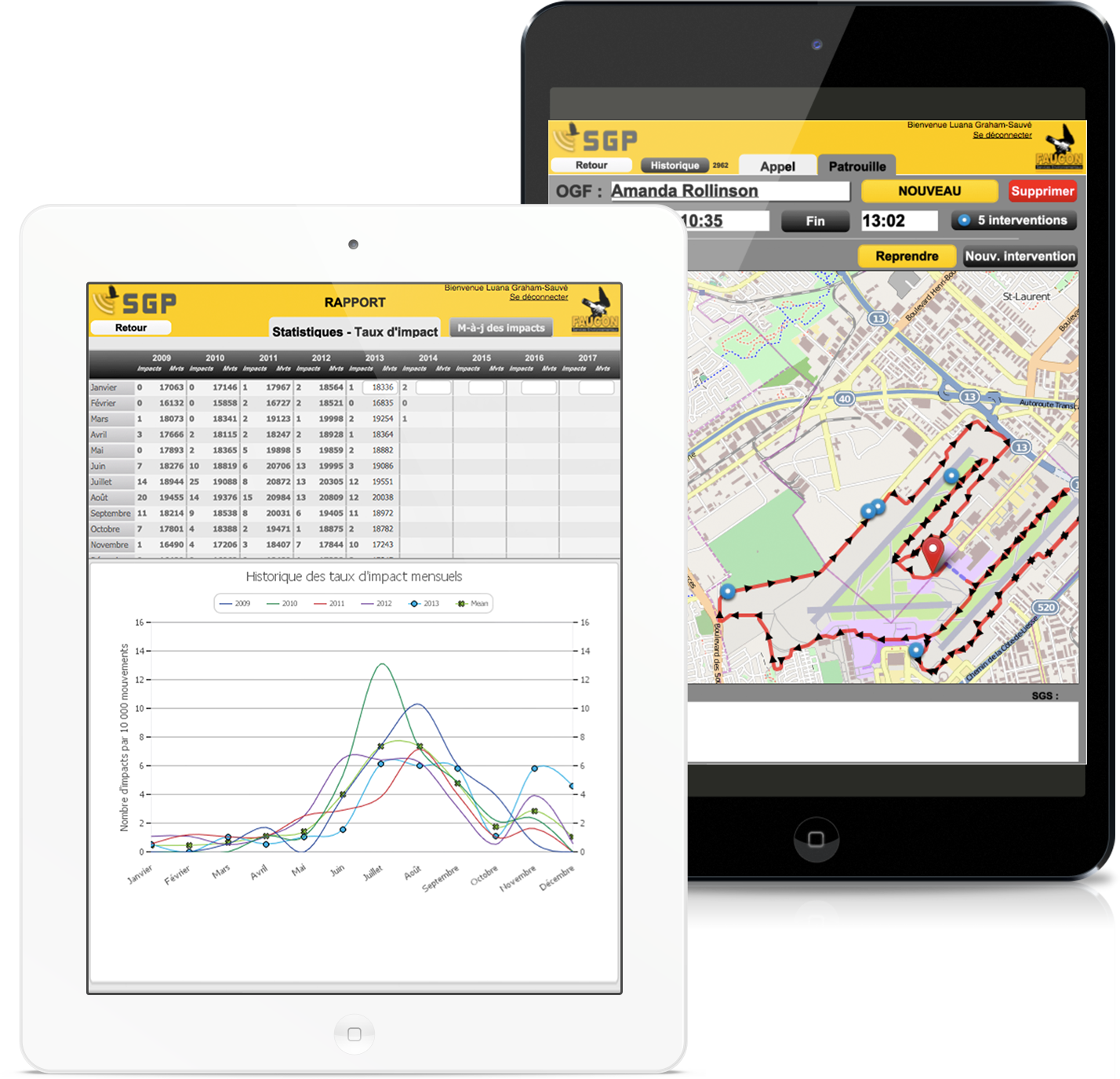
Wildlife patrols and emergency calls
- Keeps track of wildlife control officers
- Uses Interactive Maps to display their positions
- Records information and keeps detailed statistics about calls, strike interventions during each patrol
- Geolocate each patrol route, interventions, calls, strikes, etc. on the field
- Collects information on strikes in a manner similar to CADORS (Civil Aviation Daily Occurrence Reporting System)
- Implements Safety Management System (SMS)
Wildlife Risk Assessment Software

Allows to spatially visualise the wildlife hazard risk on and around the airport grounds based on the different land uses.
Computer Program
Specifications
- Designed for airport managers and land-use managers
- User-friendly and intuitive interface
- Computes geospatially bird strike risks
- Allows display and modification land-use around an airfield
- Computes bird strike risk according to an Safety Management System (SMS) scale including probability, severity and exposure
- Generates easy interpreted risk map according to a color code associated with risk
- Allows displaying of several base maps (ex.: land-use, orthophotos, topographic information, etc.)
Flight Planning
- Quickly identifies the bird strike hazard for a specific location and period of time
- Allows the delimitation of training areas
Wildlife Management
- Highlights wildlife or species activity hotspots and helps to focus efforts in terms of wildlife management
- Allows to see wildlife activity hotspots not only at the scale of the airport, but also at the scale of the bird hazard zone
- Allows to see wildlife activity hotspots according to wildlife species which represent a risk to an airport, year, seasons and aircraft type
Land-Uses Planning
- Models effects of potential land-use modifications on wildlife hazards
- Helps to identify the best location for new infrastructure/land-use
Quantifies risk on an airport as a function of wildlife and aircraft
Web – based and Free
Context
One of the most relevant uses of SMS is in the analysis of risks. The evaluation is made on a per-scenario basis, individually analyzing each strike scenario involving hazardous components with an inherent danger to operations. For example, a wildlife management plan would take into account wildlife, aircraft type and number of movements for the aircraft. The result of a SMS evaluation indicates the level of risk for a specific scenario.
The risk index is based on a combination of the probability and the severity of a scenario.
FALCON has developed a semi-quantitative method based on a series of variables such as frequency of wildlife observations, hazardous wildlife behaviours, aircraft type, number of movements, etc. This method allows for a more precise evaluation of the risk index, improving the reliability of the results.
Specifications
- Integrates all Airport Bird-Hazard Risk Assessment Process elements and those of Safety Management Systems (SMS)
- Assesses the strike risk on an airport as a function of wildlife and aircraft
- Allows the analysis and understanding of hazards caused by the presence of wildlife
- Analysis made on a per-scenario basis
- Easy to use with your own data
- Works with the following web-browers: Chrome, Safari and Microsoft Edge


